Untying the lines, Friday, October 17, 2003
There we were, all three of us–my dad, Jen, and myself–lying in our respective beds. I was listening to the rain patter on the deck wondering thousands of things at once: “Did I forget anything?”; “Is it going to stop raining so we can get out of here in the morning?”; “Is this really the smart thing to be doing with my life, instead of slaving away behind a desk working for the man?” I didn’t know the answers to any of them. But I did know one thing: I was about to find out whether or not I was ready for this trip. Perhaps I should digress and go back a few days to when we were frantically getting ready to go.
 It was Thursday and the to-do list was long: everything from changing the oil, to taking a swim in the frigid Menemsha Harbor, to checking the zinc and cleaning the speedometer. Food had to be stored and water tanks filled, but at the moment, I felt like tackling the oil. Anyone who has ever changed the oil in their car knows it’s a real pain… That’s why we go to “Jiffy Lube.” But in a boat it can be even worse. Most of the time the space is so cramped that you have to slip a hose down the dipstick hole and pump it out. The “higher powers” on Bumbré (that is, the previous owners) had done one better, then had attached a hose to the drain on the bottom of the engine so all you had to do was unscrew the cap at the end and the oil drained much faster. That, of course, saved a few thousands frustrated swears from leaving my mouth. There were plenty more to fill the air as I replaced the filter and cleaned up the mess, but after a short time the job was done and I was happy for having it out of the way.
 After testing for oil pressure and all that jazz I decided to start degreasing and scraping the engine because there were some spots that needed repainting. Always being nervous that an engine is going to start while I have my hand near a moving part I was surprised I had forgotten to turn off the batteries before I began. This would prove costly: as I wire brushed a few spots of peeling paint I got a shock and sparks from a nut I grazed.
Friday started out the same, waiting for a cold-plate refrigeration system to show up while I organized the gear to take to the boat. The weather, which had been bad all week and was supposed to stay that way, had kindly decided to change its course. we moved our departure up a day to take advantage of this development and avoid the gale-force wind forecast for the coming week.
That meant finishing my prep of the boat in less than twelve hours. If the fridge didn’t show up, it would have to be sent on down later by my father. Around 9 A.M., I squeezed into my sister’s wet suit to check underneath the hull (e.g., the through fittings, especially the knot/distance meter, which liked to host a variety of algae that kept it from functioning properly). It was not an ideal place to be so early in the morning (and so late in the season), but the 60° water wasn’t as bad as I expected, especially since the air was probably colder at the time. Through fittings confirmed, I moved on to the zinc on the propeller shaft, to make sure it didn’t need to be replaced.
A zinc is a football-shaped piece of metal that’s attached to the propeller shaft to avoid corrosion. I had a spare, but replacing it meant holding my breath and screwing the two pieces together around the shaft underwater without dropping them or drowning in the process. Poseidon was looking fondly on me because I managed to do it without much trouble. It was time to fill the diesel tank.
To avoid having to move the boat, I decided to fill a 5-gallon can (it is only an 18 gallon tank) and pour from that. To check the fuel gauge, I turned the key for some battery power. I got nothing. Usually there’s a loud buzzing before turning over the engine, but now no sounds emanated from the engine, the components, or anything–and I got no fuel reading. This was not good. It was not even 18 hours before departure and the iron horse was not working. We had never had any problems with our engine, and since it didn’t seem to be getting any power I assumed it must be something electrical. Beginning with the starter, I looked over the wires and found nothing disconnected. Then I worked my way up to the little nut I had shocked myself on the day before. It didn’t take a engineer to figure this one out; I started to fiddle with what appeared to be a reset switch on the front side, opposite the nut, which I noticed touched a wire connecting it to the switch. The button on the switch seemed to want to be pressed but when I did, nothing happened. It said 20 on the button so I assumed there was a 20-amp fuse inside that I could change, but this was not to be. I decided to take it over to the Menemsha Texaco station, where a lot of the local fishermen go; one of them must know what this switch was for and what I could do to fix my engine.
Soon there was a crowd of people–from a local lobster man, to the Marshall, the manager of the station–looking over the switch and giving advice on how to get by (temporarily) until I could replace it. Soon I was back on Bumbré going through their checklist, and I almost immediately got the engine to turn over. Now the question was, were to get the part. A trip to Martha’s Vineyard Shipyard proved helpful but produced no part. They gave me the name of distributor (Hansen Marine) who could send it to me, but they could not get it until Monday. The guys in Menemsha told me how to jerry rig it, but nobody could say if their method would hurt the engine or not. I decided to give it a go and got the part sent to a friend in Larchmont, New York, where I could pick it up later.
The jerry rig worked and it was now time to finish prepping the boat to leave the next morning at 4 A.M. There was a lot of work to be done and not a lot of time to do it. I picked up my wife on the way back from the shipyard and we started the job of organizing everything so we could so to get home in time for dinner with our third crewmember: my 73 year old dad, who had done this very trip in 1978, also on a 28-foot boat.
After packing a few things, including most of our food to go in the icebox, we headed back out to Menemsha in a taxi to sleep on the boat before our expected departure early Saturday. I prepped the line, finished cleaning the boat, and topped off the water before heading below decks with the rest of the crew. Which takes me back to where I started, lying in bed, wondering about our journey ahead.
Saturday, October 18, 2003
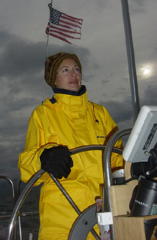
 Sometime during the night I eventually fell asleep, and before I knew it the alarm was buzzing at 3 A.M. I heard rain on the decks and knew there was no need to get up and start prepping for and early departure: my crew wouldn’t want to leave in this weather. Worries of the rain didn’t prevent me from falling back asleep, and about 6:15 I heard what sounded like the last few drops. The sun had lit the sky but it had not risen yet. My Dad and I began to get our gear together. After untying the lines and getting underway, my good friend Marshall (owner of the Menemsha Texaco, mentioned earlier) gave us one last wave from outside his station and we headed out of the harbor. It was cold and wet, but we got the sails up in a nice fresh 10- to 15-knot NE wind, which carried us toward the Gay Head Cliffs and Devel’s Bridge. We were hoping to make good time to Block Island, and if the wind held we would make the 43-mile trip in short order.
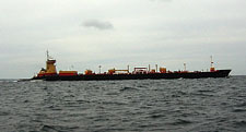
 We sailed along in 3- to 5-foot seas hoping we wouldn’t get more rain and drinking copious amounts of hot cocoa to keep warm. Once we neared the Buzzard’s Bay/Providence channel we started to see more and more large boats including a large freighter that crossed our path. Eventually Block Island emerged out of the haze and Jen breathed a great sigh of releif. This was the first leg and it was almost over, even I was relived: it had been difficult to to untie the lines and leave the comforts of home behind us, but now that we were on our way, we had a lot to look forward to.
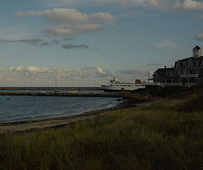
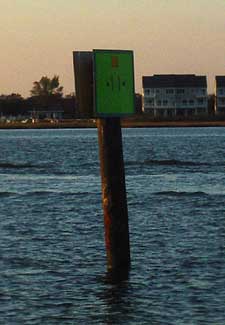
 We got to Block Island and aimed to pick up one of the lime green town moorings, but when none were found we figured no one would bother us on a private mooring in late October. Since it was only 3 o’clock and neither Jen nor I had ever been to Block Island, we decided to go in and have a look around. As we prepared our dingy, many boats entered the harbor and started to fill one of the docks near our mooring. It seems that many Rhode Islanders had decided to head to Block Island for the afternoon, including an old 12-meter America’s Cup boat, Columbia. We walked into the main town from New Harbor and realized that Block Island is truly still just a summer retreat. There only seemed to be hotels and bars along the road with a few small boutique’s and stores in between. It was like Martha’s Vineyard or Nantucket long ago before they were “discovered.” I’m sure Block Island has been discovered too, but not to the extent of its famous neighbors. Our walk didn’t take long and soon we headed back to the boat to enjoy the rest of our stay on Block Island from a distance.
 Dinner was Shrimp Newburg and soon after that we headed off to our cold beds. Not having a heater, we hoped that cooking dinner would heat up the cabin, but the rapidly dropping temperatures outmatched the heat of the stove. We were expecting temps in the low 40s so we got out some extra blankets and layered up.
The Race, Sunday, October 19, 2003
 We awoke the next morning at 7:45, in no hurry, having to wait for the tide at The Race to turn in our favor. It was going to take almost four hours to reach The Race so we didn’t need to leave until after nine. We ate a leisurely breakfast and headed out about 9:30, it was cold but dry, so all seemed good as we headed out with light north winds. Just as the wind picked up, a rain cloud engulfed us and soon I was the only one on deck, steering as it rained harder and harder. The wind wasn’t so strong that we had to take down the sails, but the wet rain didn’t help the temperature, which was still somewhere in the 40s. We raced along sometimes topping out at 8 knots hoping that it would stop raining anytime. It did on and off and eventually and dad must have felt sorry
 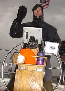 for me because soon we were all on deck getting soaked with Dad at the wheel. We got through The Race at just the right time, and decided to skip any thoughts of heading too far down the Connecticut coast. We started toward our original destination, Old Saybrook, which was 12 miles away. Once in the Long Island Sound we started to see more and more large tankers and barges, some being towed by tugs with cables hundreds of feet long.
We cautiously headed into Old Saybrook breakwater and into the Harbor 1 fuel dock. There, a guy in shorts greeted us with a strange hello, obviously wondering what we would be doing out on a day like today, and we greeted him back with a strange stare wondering what a guy who works the docks would be doing wearing shorts on such a cold rainy day. He got us a slip and told us a good restaurant to go to and where the showers were. This was all we needed to know as we quickly headed off to to get clean and warm.
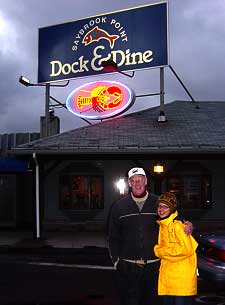
 After washing ourselves and the boat, we made for the Dock & Dine for dinner. We decided that we should have a go at getting to Larchmont, New York, the next day–68 cold miles away. To do this we needed to get up early: my dad’s original thought of setting out by 5 A.M. was vetoed by the Captain… I changed it to a 3 A.M. wake-up and a 4 A.M. departure. The groans of the crew were loud, but I new Jen wouldn’t want to approach Larchmont in the dark.
 We wanted to get to Larchmont for a couple of reasons, not the least of which was that a replacement to part (see above) had been sent to a friend there. Also, this was where we planned to stage for our journey through New York City and the mighty East River. If we didn’t get through New York soon, we might not have my Dad’s services down the Jersey shore as he needed to be in Baltimore for a meeting by Monday the 28th. Plus, the long trip down the Jersey shore would be better and more fun with three rather than two. After dinner we climbed into bed and had the lights off before 9PM.
Monday, October 20, 2003
 Sixty-eight miles in a car can be covered in about an hour; in a 28-foot boat, you’ll work hard to average 5 miles in an hour. We would struggle to cover that distance in under 13 or 14 hours, and the sun sets in October just after 6 P.M. Hence the 3 A.M. alarm clock.
We were off by 3:35 in the morning. It was cold–it had been in the 30s the night before with frost warnings. We navigated in the dark out of the harbor and raised the jib with the engine easily making 6.5 to 7 knots–I was happy. A quarter moon was out and you could see the stars clearly as we dead reckoned using the GPS as a back-up from marker to marker in the dark until we reached a mark at the end of Long Sand Shoal. Our next mark would be 28 miles later. Dad headed down for a nap, and I turned on the autopilot and watched out for anything we might hit while trying to keep warm. Jen got up about an hour or so later and poked her headed on deck with an uneasy look. She wasn’t sure about leaving while it was dark, and when she climbed on deck, her nervous look told me that the beautiful moon and stars above were doing nothing to qwell these fears.
Soon the sun began to lighten the sky to our east and that look of nervousness turned to a frigid stare as we both tried to keep warm in anticipation of the warm sun. It was to be a beautiful day, much to our satisfaction–just what we needed.
 After many hours making good time, the weather report proved true and our northwest wind started to turn to the west and southwest. This put it right to where we were headed and our progress immediately suffered. We went from over 6 knots to 5, until we settled in at under 5 knots. This was not going to help us get in before dark as we still had 30 miles to go. I started tacking back and forth from Long Island to Connecticut, and while our speed improved greatly our progress was about the same. As the day started to get later and later, I turned on the engine and we motor sailed. This helped us to get higher up into the wind, but only slightly sped us to our distination.
Settling in to our fate we abandoned any thoughts of early arrival and kept going down the coast. At about 5:30 P.M. we made it into the harbor and picked up a guest mooring at the Larchmont Yacht Club. From there we met my friends, had a drink, and picked up the engine part before heading but to the boat for dinner and bed.
Tuesday, October 21, 2003
 We decided to have a day of rest on Tuesday for a few reasons: to catch up with a few people in the area and because the wind was suppose to blow hard from the southwest that day and that was the direction we were headed. However, we discovered the hard way that Larchmont Harbor is not well protected from the southwest, as we pitched around all night and into the next morning.

In the morning, we found that Larchmont was a very nice suburb of New York City, but the most exciting thing was the fact that the public library had an internet connection. So we got to check in with the world and find out that unfortunally the Yankee’s and Marlin’s were tied 1-1 in the World Series, which is okay as long as the Yankee’s lose 4-1 [Ed.: Not quite such a blowout, but the Marlin’s won.]. after which we rested the remainder of the day roughing it at the beautiful Larchmont Yacht Club, an upscale establishiment, but being well into the off-season, they didn’t seem to mind that we weren’t dressed the part.
 That night we welcomed our friends Tim and Marcia to the boat for dinner. We had hoped they would be able to make the trip down with us to New York, but jobs and the factors involved in getting home if weather didn’t cooperate forced them to abandon their plans. They met us in Larchmont to enjoy dinner on the boat. We got to bed late–11 P.M., two hours later then normal.
Wednesday, October 22, 2003
 The late night made getting up harder than usual, but at 6 A.M. the changing of the tide called on us to get going so we could make it through New York and down to Manasquawm, New Jersey, 57 miles away. We had all been looking forward to our journey down the East River and through New York City, and this chilly morning was going to get us there.
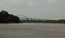
 We followed our course toward the Throg’s Neck Bridge which was to be the first of nine bridges we would go under before heading into the Atlantic along the New Jersey coast. As the tide got hold of us it made up for the fact that the city had stolen our wind. We wound down the river past Lagaurdia and Riker’s Island before shooting through North and South Brother Islands toward the Hell’s Gate Bridge. Manhattan was coming into clear view and the tide was keeping us over 7 knots.
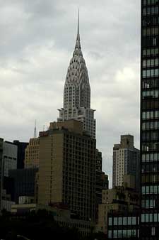
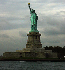
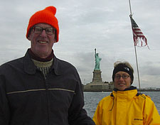
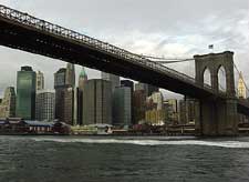 The Chrysler and Empire State buildings came into view as we sailed past midtown, but the exciting stuff was yet to come. It didn’t take long for it to come as the Brooklyn Bridge and Statue of Liberty emerged from around a bend in the river. We planned on getting as close to “Lady Liberty” as the Department of Homeland Security would allow and now that we could see her we only had to avoid the hundreds of ferries populating the channel in the path. Jen did this successfully and I snapped shots of the fair lady from the bow. There was a motor yacht near her as well, and as we started to sail away the Coast Guard decided to board the motor yacht since he seemed to be casing her more than we had. Now we only had to head through the narrows and under the Verazano Bridge.
 After we went under that bridge, we only had 33 more miles to Manasquawm Inlet. It wanted to rain all day, but we only seemed to get a few sprinkles. We entered the inlet around 4 P.M., after another ten hour day, and got a berth at the fuel dock at the Briel Marine Basin. We saw a beautiful sunset before heading off to dinner at the Sand Bar Restuarant. We tried to stay up awhile to watch the Marlins/Yankee’s but we were too tired and anticipating the 51-mile sail to Atlantic City the next day.
Hell offshore, Thursday, October 23, 2003

 The tide was banging the boat into the dock at 4:30 in the morning, so after Jen woke me up to ask if we should move the fenders I responded “Yes,” but made no movement toward doing such a thing. She thankfully got up that cold morning and fixed the problem. At 7 A.M., we got up to a beautiful day with a forcast of 15- to 25-knot winds late. Dad and I looked forward to a fast sail, while Jen was a bit nervous. We had to wait for the train bridge to open before we headed back out into the Atlantic around 7:45.
The day started off great with steady wind from the NE, but around midday things started to change. The clear blue sky clouded over and the wind and waves started to build. By the time we passed Barnaget Inlet it was belowing 25 knots with gusts over 30, and a small Coast Guard boat sat off our stern keeping an eye on us to make sure we were doing okay. This was not the sailing Jen had signed on for, and even I was not enjoying it very much, especially since I was having to steer most of the day because Dad was below sleeping. We had put two reefs in the main, but still had the jib out and we were moving along between 6.5 and 7 knots–a pretty good pace for Bumbré.
 Thankfully the rain held off, but that did not mean we didn’t have our problems. While I was at the helm late in the day, I noticed that there seem to be a dock line on the bow over the side. Thinking it was probably a short line holding I the dingy in place I believed it could wait to be taken care of until I was relieved from the wheel by my Dad (neither Jen nor Dad wanted–or needed–to go up on the bow in the heavy swell we were having). I forgot about it until as I was at the wheel and watched our fenders slowly come lose from my bungee job that morning. Before I knew it one had gone overboard and in an attempt to save the rest I quickly handed the wheel over to Jen. I saved the last three fenders, but the quick turn over of the wheel had gotten us in a bit of a state, and rather than wait for the sails to fill again naturally I figured I’d quicken the process with the iron sail: the engine. I switched her on and put it in gear only to quickly hear her stall out with a loud “clunk.” Immediately, I had an idea of what the problem was, but had to be sure she just didn’t have a bad start so I tried it again. This time she started and when I put her in gear she stalled again even quicker, and now I couldn’t get her out of gear. We had a big problem. Looking up at the bow, I saw the line over the side very tight around the deck near the cleat. I grabbed a knife and headed up to the bow, grasping at the line I couldn’t even get my figures between it and the hull, so I grabbed the line as best I could and started to cut. I had hoped to keep hold of the line, for what reason I didn’t know, I just figured I would, but as soon as the knife cut through, it slid through my grasp and into the water. When I got back to the cockpit, I could see it trailing back from the stern about two or three feet down, just where it should be if it were tightly wrapped around the prop. We were a mile off the Atlantic City Inlet in four- to six-foot seas with no working engine and a very worried wife, who was really looking forward to getting in quickly for a nice warm shower and perhaps a little blackjack.
 I was not happy and immediately called Tow Boat/US to arrange our transport into the Farley State Marina. My dad had a different plan: why not just sail right up the inlet and see if we could make it to the marina; if not, we could anchor and wait for the tow boat out of the rough seas. I nervously agreed as I pictured Bumbré up on the shoal that lines the northern side of the inlet. The wind was due west coming right out of the inlet, so with a doubled reefed main and a shortened jib, we headed in. We had studied the chart and saw that there was a shoal on the northern part, and it was very deep on the southern end of the inlet, but the southern part had small rock jetties about every 50 yards. The whole inlet ranged in width from about 100 yards wide at its mouth to 50 yards near where you turned left into the marina. We slowly headed in with dad at the wheel and Jen and I each on a jib sheet. The main was tight enough to handle itself. We started on the port tack heading toward the northern shoal and slowly tacked back and forth while the channel got narrower and narrower. Watching the depth finder, we tried to time the tacks to maximize our progress and before we new it we were heading toward the bouys marking the channel into the main harbor.
 We had almost made it, but the chart showed a shoal on our right and deep water right up to a bulkhead on our left. It looked as if we needed one more tack to make it through, but the channel was now only about 25 yards wide–not much room for error. It was about this time that dad’s and my excitment was growing, while Jen was not sure we should go any further. Seeing a small boat coming she waved it down. It turned out to be the tow boat I had called maybe a half-hour ago. The captain told us we had had to lower our sails before he could tow us. This made us nervous as we were quite near the shoal and it would mean the tide could carry us into it.
The tow boat captain seemed unconcerned, and while we took down the sails he just sat there waiting as we drifted over the supposed shoal; to our surprise, we didn’t hit bottom. We started to realize that the shoals had changed and we had more room than we thought. The tow guy seemed to understand this and after he took ten minutes to tie up our boat, we proceeded to motor directly over a few more shoals that were on the chart. He evenually got us to the end of “B” dock after more than a few attempts to land us successfully. He seemed to think we were a bit crazy as he stated more than once that he had never encountered a sailboat that had actually tried to sail into the inlet. This was confirmed by the fact that, before he had even left, I was out on the dock in the 40° weather in my swim suit getting ready to jump into the disgusting Atlantic City Marina water to cut the line off of the prop.
So I headed into the water with cheers and jeers from the crowds of sportfisherman at the fuel dock. I abandoned my initial attempt because the knife I had originally brought couldn’t cut cheese if it had to; I returned with a much sharper Leatherman.
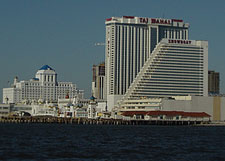
It was now after 5 P.M., and we all went to take shower and get ready for dinner. We decided on the Upstair’s Cafe at Trump Marina, which turned out to be just what we were looking for. Afterward any thoughts of blackjack at the casino were quickly dispersed by Mr. Trump’s decree that there only be $10 and above tables–that simply didn’t fit our budget. After dinner, we were off to bed and then Cape May in the morning.
The End, Friday, October 24, 2003
 This day marked the end of our New Jersey/Atlantic City experience: 36 miles to Cape May and we were all looking forward to it. It was another beautiful day, and with a small bit of apprehension about the weather, we headed out in forecasted 10- to 15-knot northwesterly winds. The weather was fine and we sailed down the coast in the cold sunshine hoping to get into Cape May early to meet my brother for the next leg of the trip to Baltimore. A few miles short of Cape May, our sail was interrupted by a loud sound that seemed like a gunshot. The engine was not on, and I knew the noise didn’t come from our boat, so I turned upwind to have a look at the boat we were about to pass to our port. From behind my jib, I noticed a boat draped in a camflouge net and a guy in it waving a shotgun at me. It seemed we were about to sail through his patch of duck decoys and he’d fired a shot to alert us, which to his delight, we did. This had nothing to do with the fact that he was waving a gun in our direction. As we passed them and I watched one of the men in the back bailing, it struck me as odd to have a green cammoflouge tarp over your boat in the middle of the blue Atlantic, but not having the time to ask them about this we sailed on.
 We made it in shortly after being passed in the inlet by the very same duck hunters. It seemed that my brother couldn’t find an easy way to get to Cape May and decided he would have to meet us in Chesapeake City, our destination the next day. So instead of getting a slip for his arrival we decided to anchor southeast of the Coast Guard station like our guide told us. We’d seen plenty of people anchored northeast of the Coast Guard station, but since it was closer to the canal and and where the guide had told, us we decided to anchor near channel marker #11. There were a few other boats in the area so my dad and I ignored my wife’s
 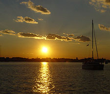 warnings about the dpeth meter reading only 4 feet and we anchored 50 feet inside of marker. After dropping anchor, it read 6 feet; my dad had figured it to be about 45 minutes after low tide, so we assumed we’d be fine, continuing to shrug off Jen’s thoughts of moving the boat. We would be leaving at around 3 A.M., one hour before low tide.
That evening it was warm enough for cocktails on the deck, and we opened a bottle of bubbly and toasted our good fortune of being done with the Jersey Shore and the Atlantic for awhile.
Stuck in a Mud Bank, Friday, October 24, 2003
The Jersey Shore didn’t want to let go of us so easily. We were woken up in the middle of the night by boats traveling in the channel and letting off wakes that would rock us back and forth. The main problem was that our boat wasn’t rocking quite right. We would roll back and forth but quickly stop, leaving the rigging loudly clanking againsst the mast. I knew what was going on and when Jen looked up at me, I could tell she did too, but we didn’t say anything, just went back to bed. About an hour later I couldn’t sleep and, believing I might have a job ahead of me, I got up and started prepping to go. It was 2:45 A.M., and I figured if we got going by 3:15 we’d be in good shape to get through the Delaware Bay and the C&D Canal. However, this plan was delayed. My dad had gotten up with me and we turned on the instruments to get going; our first sign of trouble appeared when the depth sounder didn’t work–it either showed numbers over 100 feet or nothing at all. Hoping this was just a glitch I had him at the helm while I started to pull up the muddy anchor. As I tugged the line, the boat wasn’t moving. We tried to goose it a little with the engine, but that didn’t help.
We needed to assess our situation more seriously, so I got out the lead line and tossed it over the side. Much to my disappoint it didn’t sink far, it fact it only sank 3 and a half feet before hitting the mud. This wouldn’t have been a problem, but we draw 5′ 3″ empty, which means with gear and three crew it is probably more like 5′ 6″. We were sunk in the mud as much as two feet and we had to get out before Jen was able to understand how correct she had been the day before. Our first plan was to pulled up the anchor, which was in the direction of deeper water anyway, hoping to kedge our way out. We did this and the boat moved just a little closer to deeper water. Because we were on a soft mud bottom the boat was listing so we knew we could pull ourselves out. I decided I would take a line out to channel marker #11 eleven and tie a line around it so we could pull ourselves out. So we launched the dingy so I could row out, but my plan had one problem: I am terrible at coiling rope so once I got out there with my extra 200 foot anchor line and tied it around the post I found it helplessly tangled. There I was in the Cape May Inlet in a strong tide at 3:30 in the morning cursing myself for tangling the rope. After what must have been a longer time than he expected, my father began to wonder what in the hell I was doing out there. Not wanting to scream my predicament across the inlet, I sat there untangling the line and filling the dingy with it in hopes it would not get tied up again.
Finally, after a few failed attempts–there were some unfound knots–I got back to Bumbré and to a very confused father. Nevertheless, we got the line on board and started pulling. Much to my surprise, the boat quickly started to release itself from the mud and before we knew it, we were hanging out, holding onto the channel marker. This may have been because in the interim hour, the tide had risen a bit and made it easier on us. It was now 4:15; we wanted to get underway.
I put Dad at the wheel with a red light to see the map and directions. I had to clean up the bow, which was now a mess of anchor lines and mud. First thing was to get the dinghy back on board. With Dad at the wheel about to enter the canal I wasn’t sure I was going to be able to hook up the halyard again and winch her back on. Since our dinghy is just a light hard-bottom inflatable, I decided to grab a handle and try to pull it back on. This done, I still had lines everywhere–after our experience off Atlantic City, I was going to leave nothing to chance. During this time, my dad–who, in his 73 years, has lost a bit of his keen eyesight, especially at night–was trying to navigate the dark canal by looking to the banks and seeing how close he was. I looked up every 30 seconds or so to give him an update on where to steer the boat. After nearly colliding with an old railroad bridge on our way out of the canal (the opening is narrow and hard to see in poor light), we finally made it through.
 With the canal behind us, we headed out into the Delaware Bay and toward Maryland. It was 4:45 A.M., and we were behind schedule. Since we were in a small boat, we traveled slower than most. With the engine on, our cruising speed is between 4.5 and 5.5 knots, the later only on a good calm day. Since it was forecasted to be a very calm day we knew we wouldn’t get any help from the wind, but we would get the most from the engine. Off we went, still the first ones to leave the inlet, up the bay hoping to make it up before the tide changed when we might only make 2 or 3 knots per hour (compared to 6 to 8 knots with the tide). We had lost a hour, which could be crucial as the tide was going to change against us at 10:20 and it was almost 40 miles to the entrance of the canal
As the sun rose behind us, it lit up a beautiful clear day and before we knew it, we had warm, sunny weather and we shed some of our layers of clothes. As we began to pass marker after marker in the bay, my dad announced he didn’t think we’d make it to Chesapeake City that day as the tide was going to turn against us, slowing us down to a near stop. This worried me as I didn’t want to lose a day stuck in the Delaware Bay, and my dad with his years of experience on the sea is rarely wrong about these things. He’d consistently tell us when we would reach our next marker throughout the trip, and comparing his predictions to the GPS, he was rarely off by more than five minutes. So after he consulted the Eldridge Tide Book and announced we would be hard against the tide with at least 10 miles to go in the canal, I looked for reasons for him to be wrong. The first sign showed up when, at the time the tide was to change, it still seemed to be with us, which was confirmed by the GPS saying we were making a knot over the 5.5 knots our speedometer read. Certain it would change anytime, my Dad held onto his belief as we opened the tide book for another look. We kept racing up the canal with the tide behind us while my dad discovered the information he had been looking for. It seems that our addition of Eldridge prints tide information on the Upper Delaware Bay in a completely different part of the book than information on the Lower Bay. They make it very difficult to track down the needed information and accurately oredict tidal changes in some areas. Our guess work always estimated the change to take place about hour after, instead of an hour before, a certain marker. It turns out the tide wasn’t going to change against us until about 11:45, about the same time we entered the Delaware & Chesapeake Canal. We’d make it all the way to Chesapeake City after all.
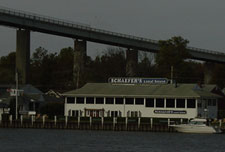
 After passing under all the bridge’s of the C&D canal, we ended up in Chesapeake City and the infamous Schaefer’s that I had read so much about. Schaefer’s had the right price for docking ($1 dollar a foot if you paid cash) so we were happy to stay, even if its facilities suffered as a result. After having a quick look around our new home we headed over to Chesapeake City in the dinghy to see what it had to offer and hopefully get some ice and milk. We had read that it was a nice town and after fighting through the traffic on the C&D, we pulled up our dinghy to the Chesapeake Inn and Marina’s dock to have a look for ourselves. The Chesapeake Inn seemed to have a lot of boaters doing what boaters do best–drinking. At the Chesapeake Inn, they seem to do it with a added little flare: the outdoor bar is named the “Tiki Bar,” even if the shores of the canal give you a feeling far from those I had felt in the tropics. We decided to bypass the Tiki Bar and quickly headed out into town. The main part of Chesapeake City didn’t consist of much; in fact, it was pretty much just restaurants and antiques shops. We weren’t in the market for antiques and our budget didn’t include expensive lunches, so after finding no stores to buy ice or milk we headed back toward the Chesapeake Inn hoping they would at least have some ice for us. The bartender at the Tiki Bar gave us a bag for no charge, and we were off to fight the traffic on the C&D, and hopefully find my brother Johnny waiting with my dad on the boat.
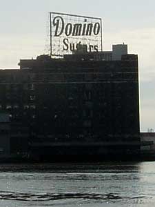
 Johnny had come up from Baltimore to join us for the sail to Annapolis. We sat talking for awhile before heading off for dinner at Schaefer’s Canal House. After watching a few innings of Game 6 of the World Series, exhaustion set in and we headed off to bed. But before we got to bed, the two passengers who were eventually headed for Baltimore–Johnny and my dad–bribed Jen and me with Internet access, laundry, and free dockage in downtown Baltimore if we would change our destination city. It was all too tempting, so we decided to dock in Baltimore instead, bringing me back to the city of my birth. This would put us up the Patapsco River, 10 miles from the main part of the Chesapeake.
Chesapeake Bay an Introduction, Sunday, October 26, 2003
 We woke at 6:15 A.M. because of daylight savings time and, after getting help from some friends we had met aboard Contessa, we headed off at about 7 toward the Chesapeake and the city of Baltimore, over 40 miles away. The going was slow because we were against the current in what remained of the C&D Canal. But slowly we made it out and were able to raise sail once we were in the Elk River. The wind was light and we were making slow progress as we headed toward Poole’s Island. This meant tacking around Poole’s Island in three to four foot seas, which just wasn’t a whole lot of fun and did not give me a great introduction to sailing in the Chesapeake. My brother, who could only spend one day on the boat wasn’t upset at all, just happy to be out sailing. At about 3:40
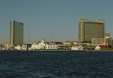
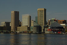
 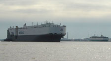 P.M., we headed under the Francis Scott Key Bridge and toward Fort McHenry which guards the entrance to Baltimore’s Inner Harbor.

 After getting in, we cleaned up before my sister and her husband showed up and we all headed out to dinner. Since we were near Baltimore’s “Little Italy,” we decided to go Italian at Luigi Petti’s where we had very good but very heavy and rich Italian dishes, which very few of us were able to finish. Then, much to our dismay, it started to rain and we headed back to the boat hoping to survive what would prove to be a very wet couple of days.
Out on our own, Tuesday, October 28, 2003
 After our wet day in Baltimore provisioning and visiting with friends we had one more dinner with the family on Monday night and prepared to leave the family behind. This was going to be our first day out without some sort of family as crew and I felt sad when we got back to the boat on Monday night to be leaving them behind. But Tuesday problems quickly put those feelings out of mind as we had two dead batteries to contend with.
 It seems that our boat’s two batteries consisted of one starting battery and one deep cycle battery. Being an engineering moron, I figure they were pretty much the same. I now know this is not true. You see, a deep cycle battery can be used for starting as well as powering things like lights, radio, etc., whereas a starting battery should only be used for starting as it gives off good volts but once it gets drained it can’t be charged back up again. I had been giving the batteries equal time so as not to wear one down more than the other. For the last few days, I had been using battery number 2, which
 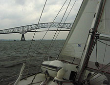 unknown to me was the starting battery that should never be used to power the lights, etc. (no wonder the lights were getting dim). It turns out that, because I was doing this the other battery was trying to help out the starting battery, and we, subsequently, killed them both. This hurt the cruising budget for the week. We were now plugged into shore power, and I’d hoped they would recharge in time to meet our schedule, but of course, on Tuesday morning, there was nothing.
 Fortunately, the father of my childhood friend Dave was coming down for a visit and was only too happy to give me a ride to West Marine. There I got marina battery education 101 from the sales guy and bought two dual purpose deep cycle batteries (dual purpose meaning for starting and power things like radio /lights) instead of one starting and one deep cycle. Why you would have anything else is not understood by me, since the price is pretty much the same. After that we took a nice cake from Dave’s parents and we headed off the Inner Harbor East Marina toward Annapolis.
Leaving Baltimore, it was a glorious sunny day, but as we passed under the Key Bridge it turned cloudy, so the rest of the day we motored with a light wind on our nose. We got into Annapolis around 5 P.M. and decided to stay on a mooring there, having read it was poor holding ground out in the anchorage. We cooked some dinner and enjoyed another sunset aboard Bumbré.
Meeting with the wise man, Wednesday, October 29, 2003
 Soon after I got up the next day, I heard a boat off the stern and I looked up to see two very official looking boaters with full foul weather gear on and harnesses with life jackets. It was the Annapolis Harbor master’s staff out to collect the fee. I had heard they were prompt and official in Annapolis but it was still before eight. We paid our $50 (2 nights at $25 each) and were left to ourselves, but not before one of them informed me the my rolling furler jib
 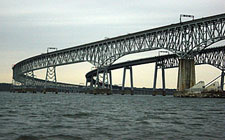 bowed and that I should probably tighten up the forward stay. So after breakfast I started to dismantle the furler to get to the turnbuckle, so I could give it a few turns. After successfully not losing any of the pieces to the furler over the side, the job was done and we were anxious to get into Annapolis to have a look around.
When I was a child, my mom had been a board member of the Hammond Harwood House, a historical house in Annapolis. Still, I had never been to that city, even though Annapolis is just a short drive from Baltimore. This was going to be the first visit for both Jen and myself. We got ready with our toiletries and other things we needed (we really needed a shower, which you get for your $25 nightly fee) and were about to head off when my wife saw a dinghy floating by with two people in it going with the tide. It seems their engine wasn’t working and, just like me, they hadn’t thought to bring the oars before it died. So I hopped in our dink and towed them back to their boat, Free Radical.
 I picked up Jen and we headed back over to Free Radical to see if they needed a ride to get supplies. They took us up on the offer and we once again towed them, this time to the dinghy dock. After cleaning up, we started looking for an Internet cafe to catch up with friends and family. We had bought a wireless card for our laptop and I was anxious to try it out. We quickly found an Internet cafe/coffee shop/bookstore, The Hard Bean & Bookstore, and Jen got on one of their free computers while I booted up the laptop to try to get on the wireless network. Unfortunately, the new D-Link card I bought in Baltimore didn’t work–it liked to make the laptop blue screen and crash so fast I had no time to read the blue screen message to see what was wrong (as if I could understand it anyway). I called D-Link who told me it was a Compaq problem (the laptop maker). So to avoid a lengthy time on hold in Compaq’s customer service department, I emailed them on one of the free computers at the Hard Bean.
I had wanted to test out the card at CompUSA but I was informed their wireless network was down and that they had never had anyone have a problem with a wireless card so I shouldn’t have any problems either. Well it seems that I am the first one to have a problem, which is unfortunate since access to CompUSA or even a car to get there is hard when traveling by boat. Eventually, Compaq told me to forget using the D-Link card and get a new one. That was easy for them to say… The nearest accessible CompUSA was in Norfolk, Virginia, where we hoped to be in just a few days to visit Jen’s aunt and uncle.
We left that problem behind and headed off to see Annapolis and find a place to get some lunch. We saw the normal sights the State Capitol Dome (the oldest wooden dome in America) and the small boutiques of main street before finding a small diner off the beaten path that had very reasonable prices. After lunch we hit some stores, looking for cruising guides to the Chesapeake Bay and some boat supplies at Fawcett’s.
 We had decided to spend two nights in Annapolis so we could go out to dinner at the Ram’s Head with my sister and brother-in-law, as well as her friend Valerie and Valerie’s dad, who had sailed the route we were taking several times over ten years. We hoped to soak up as much knowledge as one could in a single dinner. Valerie’s dad looked every part the “old salt” with a long gray beard and leathery skin from years of weathering by sea air. As we talked, he filled me with information in his mild-mannered way, as I struggled to take it all in–it was hard to figure out what to ask after a while.
Traveling the intercoastal waterway (ICW) isn’t typically considered dangerous, but like anything, the more you know the less trouble you will get in along the way. While grounding and trouble spots are going to happen to everybody, best ways to deal with them or avoid them are not common knowledge to someone who doesn’t know the waters. I hoped to extract as much of this sort of knowledge as I could from Valerie’s dad. After two hours I was filled to capacity and hoped I could remember it all. Tomorrow we would head to Solomon’s Island, then Deltaville, Virginia, which is within striking distance of the ICW. The sails would be put away in favor of the “iron sail,” which would hopefully get us through the shallow waters of the Dismal Swamp and beyond.
Anchoring, no problem, Thursday, October 30, 2003

After two days in Annapolis, we started out early so as to make Solomon’s with enough time to have a look around on shore. As we left Annapolis we watched the sunrise yet again to clear skies and what is known to sailors the world over as a “dead calm.” There was so little wind that the water was glassy and flat, which meant that, instead of having the wind directly into our bow we now had no wind at all. This meant a nice smooth motor down the coast, but it did nothing to improve the Chesapeake as a great sailing destination in my mind. Nevertheless, it was a fair-weather day, which, after the cold run to the Chesapeake, we enjoyed immensely. Before we knew it we were closing in on Solomon’s Island where we planned to anchor for the night. Despite being a little close to the stern of the boat in front of us, we headed in to have a look at our surrounding area.
 After checking out the goings on around the island, and picking up some ice for the boat, we sat on deck enjoying the afternoon and once again partook in many sailors’ favorite activity, watching the other boats come to anchor. Little did we know, it was us that was going to be the show that night.
 As Jen was making dinner I went up on deck as the tide began to change. Unfortunately for us the boat I had anchored close to wasn’t cooperating with the tide. As everyone else in the harbor was swinging, this large sailboat had decided that she was going to sit right where she was. This would have been fine except for our close proximity: since this sailboat had decided not to abide by the rules of the tide, we were now getting quite close to her stern. It was pretty dark now, and we had to move Bumbré so not to risk playing bumper boats.
 This of course is much harder to do at night when hand signals aren’t as effective. Since I didn’t want to raise any attention, I was also
  reluctant to yell to Jen at the helm; I just hoped she would understand. The communication was bad and she didn’t know where I wanted to go, so we had a little trouble finding the right spot. Before we knew it, the hook was down again–I just had to make sure it held. Since it was so calm in the anchorage it didn’t take long before we were back to dinner below. Afterwards we went right bed knowing it would be a long day tomorrow if we were to make Deltaville, Virginia, more than 50 miles south.
Halloween tacking into Hell, Friday, October 31, 2003
 The weather forecast for Halloween had been much like the day before, so we figured we would have a nice liesurely motor down the coast to Deltaville, Virginia. As we headed out of Solomon’s and around Cedar Point, the weather proved to be a bit different than it was forecasted. The wind was from the south, but instead of under 5 knots, it was 10 to 15 right in our face. This made motoring very slow (under 3 knots per hour), which meant it would take us twice as long to reach Deltaville (that is, way after dark). We decided to raise the sails and tack back and forth across the bay, hoping that, in three or four tacks we would make to Deltaville. This would add a lot of miles to the journey, but greatly improve our speed (to way over 6 knots). We had been told by our friend’s father that the only part of the Chesapeake that gets really unsettled seas was the mouth of the Potomac River. Unfortunately, our route would mean we would be making a tack right in the mouth of the river. But we headed off anyway toward the Eastern Shore of the bay making 7 knots. After a nice run we made our first tack directly toward the mouth of the river. We had been watching the boats with more powerful engines making their way under power, and as we tacked back, we started to get near them right in the mouth of the river. They continued to head south and we started into the Potomac hoping that we could get far enough south to make Deltaville after tacking back toward the Eastern Shore. After heading toward Tangier Island, we knew we were not going to make Deltaville on our next westerly tack. It looked as if we would have to suffer our first defeat and not make our planned stop that night.
I still had some hope and as we tacked back toward Deltaville. I thought we might be able to fight our way south and make it anyway. But once we started on our course, all hope was lost as we were still heading north of the Rappahannock River (Deltaville is south of the mouth of the Rappahannock). This meant we would have to go to Plan B, which was to head into one of the numerous creeks to the north of the Rappahannock. Unfortunately this would add ten miles or so to tomorrow’s journey when we hoped to make Norfolk. We most likely would not be in Norfolk by our goal of November 1st.
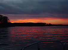 We decided to go into Indian Creek which is one of the waterways in Fleet’s Bay north of the Rappahannock. It was a long hard go into the creek especially since Hurricane Isabel had taken out a lot of the markers that lead in, making our search for the correct entrance harder. Once inside and out of the wind and waves, the creek calmed and we picked a nice cove to drop anchor. As the sun set over the trees we were relieved and happy to be anchored in such a beautiful place all by ourselves. We ate some dinner and went to bed so we could get an early start in the morning and hopefully make Norfolk. There were no candy or trick-or-treaters that Halloween, but as we watched the sunset cast shadows off the trees over the water we wouldn’t have wanted it any other way.
2 responses to “Untying the Lines, October 2003”
Harman – This is amazing! And to think it all probably started for you the summer your family sailed for a month – while we were renting your house in West Chop! If only Pittsburgh wasn’t landlocked, I’d offer to put you all up for the night! Can’t wait to read your log as your travels get underway. Safe Sailing! Julie
Sorry we missed you when you set sail! Please keep in touch as you venture south…we look forward to hearing from you. Bradley all ready misses you, Jen! Much love and smooth sailing, M,K,B&B