As part of our effort to bring you essential stories and information on travel and culture, Travel Outward presents you with our first ever “Traveler Profile,” where we will examine the lives of individuals making a name for themselves in adventure travel, education, and the cultural experience. For this inaugural piece we introduce you to Nancy Collins, co-founder and president of the adventure travel company Global Adrenaline. In the coming months, we hope to offer more material from the logbooks of Global Adrenaline, including feature articles based on the adventures they bring you.The word “overachiever” comes to mind, as I examine her resume. Her education alone is impressive, if not intimidating–she graduated with honors from Princeton University with a degree in economics, earned her Master’s of Science in development economics from Oxford University, and an MBA from Harvard, all before turning 32. Then there’s her employment history: five years working in corporate finance between New York and Sydney, Australia, with the investment bank J.P. Morgan; two summers with the International Rescue Committee (IRC) helping to pave the way for that nonprofit refugee relief organization to provide long-term care to people in need; and a year with the World Bank managing funds for much-needed supply of power to countries around the globe. All the while she was seeking action, adventure, friends, knowledge, and more by planning trips for her classmates, coworkers, family, and herself.
It’s true, this is the resume of a classic overachiever. But to be sure, she’s now doing exactly what she wants. As the president and co-founder of the adventure travel company Global Adrenaline, Nancy Collins is bringing curious people to remote regions of the world that they might never have otherwise considered. And subsequently, she’s helping to foster rich ideas, images, and knowledge of those places and cultures in the minds of a growing population of travelers.
And what of all the development, business, and economics education she amassed over the years? Well, according to Collins, it’s helping her achieve these goals in the best way she knows how.
Nancy Collins comes from a military family. Her father was in the U.S. Navy, and she spent her childhood moving around the country, mainly between Southern California and Washington, D.C. She speaks with the clipped pace of someone not used to staying in one place for very long, and while she didn’t get into the “business” of planning trips until the end of her undergraduate years, she acknowledges that her mobile upbringing influenced her as a planner and organizer, as though she’d been doing it all her life.
“When I went to college,” she says, “I thought I’d be a doctor. Then I thought I wanted to be a math major.” But a few stabs at the complexities of advanced linear algebra quickly changed her mind, and Collins took on economics as her primary area of interest. On the side she started organizing class functions and get-togethers, and after graduating, she followed in the footsteps of so many young people with a background in economics: she went into finance. Over the course of her years working with J.P. Morgan in both New York and Sydney, Collins developed a heartfelt respect for the company that she is quick to voice today. “J.P. Morgan was great,” she says. “If I were to get back into that kind of work, I wouldn’t want it to be with any other company.”
But in the end, she was drawn back to school. Collins entered a Master’s program in developing economics at Oxford, and followed that with an MBA from Harvard Business School (HBS). She spent the summers between in Macedonia, Kenya, Tanzania, and Burundi with the IRC, and also continued her hobby as a travel and social planner.
“I’ve always had an interest in developing countries,” she says. Upon completing her program at Harvard, she went to the World Bank in Washington, D.C., as an investment officer helping to fund the construction of power plants in Chile, Argentina, and India. But Collins grew restless. She appreciates the results the World Bank’s labors, but Collins wanted to find a place with less bureaucracy that allowed her more personal freedom and control over the challenges she took on.
Soon after leaving the World Bank, her career took yet another turn. A group of friends contacted her with a proposition–“They told me about a company they were starting and said they wanted me to be a part of it. They didn’t know what part yet, but knew I would make a good fit.” In their own words, her new partners needed “somebody who can make order out of chaos.” And they were sure Collins could do just that. The company was London-based Altgate Capital–an internet startup that worked closely with the European finance community–and while it was a short-lived endeavor (Altgate has since closed its doors), it opened Collins’ eyes to the potential of being her own boss. Within months of leaving Altgate, she and new two business partners founded the adventure travel company Global Adrenaline. It was an opportunity to combine her interests in developing world cultures, her talents as a travel and events organizer, and her desire for more autonomy in her working life.
At Global Adrenaline, the business is about “planning trips for young, educated professional people,” Collins says. “There aren’t many companies that focus on that market alone.”
The adventure travel industry is a crowded one. There are scores of companies that include in their clientele the niche market at which Global Adrenaline is aimed specifically, and many of those are much larger than Global Adrenaline will ever be. But very few set their sights solely on young academics and professionals, and that, according to Nancy Collins, is part of what makes her company so unique.
“To be good at what you do, you have to be focused on your customer,” she says, “…people are looking for very different things in terms of educational and physical aspects of their trip: the 12-year-old will want one thing, the 30-year-old will want another, and the 60-year-old will want still another.”
Global Adrenaline markets itself primarily to a group of people they know will be both intellectually curious and physically able–their clients want to go where they’ll be able to experience pristine nature and cultures that haven’t been overrun by bus tours and billboards. They want to go where the average family vacationers will not, if only because it’s hard to get there. But the company differentiates itself from its peers in another way–while many of the bigger names in the industry will cater to either backpackers on a shoestring budget or wealthier individuals who can afford extravagance when they travel, Global Adrenaline likes to balance elements of luxury with the realities of traveling in the third world, and they try to make this experience affordable across a broad range of incomes.
“It would be wonderful if we could be truly global,” Collins says, referring to the company’s name, “but we add a lot more value by organizing trips to places that are challenging in very specific ways.” Part of this sense of challenge comes from traveling to more remote regions that take an extra measure of effort to reach. Global Adrenaline has organized programs such as cruising to the Falkland Islands and the rugged Antarctic Peninsula, rafting and kayaking the rivers of Patagonia, trekking through the Tsering Kang Himalaya in Bhutan, or climbing the snowy heights of Mount Kilimanjaro. They set themselves apart by including in their staff of local guides, individuals who are authorities in specific fields. For instance, on a trip that takes adventurers hiking to the north face of Mount Everest, one of the specialist guides is also a professor of Tibetan studies at a major New Zealand university who is fluent in local dialects and an expert in Tibetan culture. It goes without saying, there are great benefits to having someone with such intimate cultural understanding as a guide.
But for Nancy Collins, there’s more to consider when building a travel program than the interests of her clients. Part of her–and thus, Global Adrenaline’s–philosophy is to give back to the communities they visit. “We make certain kinds of business choices that will be economically advantageous to local communities,” says Collins. “We develop itineraries so they have culturally sensitive and educational elements.”
This means, for example, providing accommodation in locally owned inns and houses, and using local suppliers, guides, and more, in an effort to ensure that all the money spent in each community goes back to that community, and not to governments and organizations that are likely to spend it elsewhere.
Collins is open about seeking clients eager to delve into the realities of a culture, even if those realities are at times harsher than our own. But it should be made clear that Global Adrenaline clients aren’t expected to sacrifice their overall comfort in the name of cultural immersion. Each trip is staffed by guides who double as gourmet cooks, fixing daily rations that often blend local flavors with western-style cuisine; and while accommodations are typically split between lodges and tents, Collins works to ensure her clients are happy and comfortable in both: lodges tend to be reasonably priced three- or four-star establishments, and camp sites are often chosen for their spectacular settings and can include solar showers and a private “toilet tent.”
“I’m definitely more detail oriented, than a ‘big-picture’ person,” says Collins, “which has worked out perfectly because, when you’re planning a trip for someone, everything has to be perfect.”
When asked about her own ideas on the people and places she is getting to know, Collins’ tone turns to that of an academic who began her journey studying the world through economics. “Broad generalizations can be made across cultures in terms of their level of economic development,” she says. “There are a lot of things that are common to developing countries that are different for developed countries…” She goes on to talk about family size, income, education, and religious freedom as indicators of social development, referring often to the gaps between first-world and third-world nations. They are valid and well-constructed points that demonstrate her insight into the evolution of modern societies, but behind the academic jargon, one senses Collins has a greater, if simpler, understanding of what she would like her clients to take away from their trips: there are opportunities to learn that goodness exists in the differences between us, and we can interact with these communities in a way that benefits everyone. Certainly, in global times such as these, there are few more important lessons.
Collins, herself, has gone on most of the trips her company offers, and–like any good business person should–she makes sure all of Global Adrenaline’s employees have a chance to experience them as well. “My favorite trips are the ones furthest from anything resembling civilization,” she says. “I think I get the most out of a trip when I am challenged both physically and mentally. I don’t like to be spoon fed a cultural experience–you have to go out and do it.”
As with most things in Nancy Collins’ life, the future of Global Adrenaline cannot be predicted. She’s sure of its longevity–“it will be here ten years from now,” she says with confidence–but the rest remains to be seen. “It takes a lot out of you on a personal level to start a business, but I wouldn’t do anything differently. It’s very personally rewarding to dump yourself into something that you have a vision for.”
Collins follows a “learn-as-you-go” mentality, believing that Global Adrenaline will grow larger as it matures; but while undoubtedly she would like to see her company included among the big names in adventure travel, she seems hesitant to turn it into a physically large company. “That’s not what I want it to be,” she says. “When it’s smaller, it’s more like a family.” And if there’s one lesson she’s taken away from this challenge, it’s this: “you realize just how important friends and family are.”
One senses there are many more turns in Nancy Collins’ life that even she cannot foretell. From Princeton to the World Bank to Global Adrenaline, she is an adventurer on an epic journey. And while we may not be there every step of the way, we can at least feel at ease in the knowledge that this is one person who’s working hard to make our world a better place.
 The 9th-century founding of Novgorod by the Viking Rurik initiated a more than thousand-year history of wealth and war, trial and loss, conquest, Communism, and tyranny. The monarchic splendor and seething peasant ideology of old Russia, coupled with the complex social, economic, and political changes brought about during the Soviet era, survive today in one form or another in what is possibly the most enigmatic yet of this country’s many incarnations.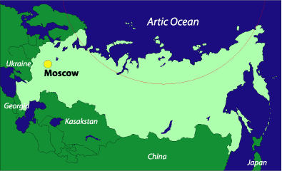
 Egypt might be considered the world’s oldest tourist destination. With a plethora of cultural artifacts dating back thousands of years, and a long history of artistic, political, intellectual, and commercial milestones, the country and region have been attracting travelers since ancient times. The pyramids and tombs are not the only reason to visit Egypt. There is an extraordinary amount of art and architecture including relics from centuries of Greek, Roman, and Arabic occupation. All along the River Nile you can see different parts of Egyptian history that have survived thousands of years of cultural change and the rapid growth.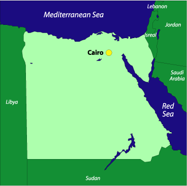

 Australia is one of the world’s most unique natural habitats. Because it is isolated from most of the world, it has a wide variety of animals unique to its continent, and landscape that seems as impossible to live in as it is stunningly beautiful. It’s hard to justify trying to see all of Australia in just one trip. You will see some of the best beaches, experience some of the most inspiring wildlife, and meet among the finest people the world has to offer.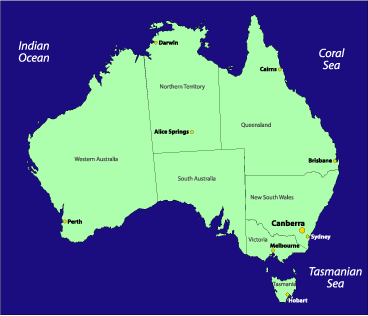
 I was already aware of the intricacies of British culture, having lived in England previously as a history teacher at a rural boarding school, during my first year out of college. But I later moved to the capital city–working toward a Master’s degree in Environment and Development at the London School of Economics–which made that prior experience seem about as exciting as reading VCR instructions. What struck me most was London’s diversity, geographical mix, and relentless pulse.
 spoken by statuesque women in fully robed regalia. My local borough (I lived in Herne Hill, near Brixton) equips its police officers with a handbook on how to approach citizens in over 20 languages. Walking from the bus stop to my house, I passed by Jamaicans, Trinidadians, Poles, and Koreans; flags waving and music blaring outside their shops and homes. All of this brought to mind a metaphor usually reserved for my native country: London is truly a great mixed salad.
  There is much less national identity in London, these days, as opposed to, say, during the time of Splendid Isolation–the national flag, for instance, carries very little symbolic value for most Brits, and there is no equivalent to the American “Pledge of Allegiance.” Each nationality retains its own cultural identity, merging seamlessly in the context of the professional world, while simultaneously promoting unique fashion, food, style, and slang that burst and fade in friendly competition. One can symbolically travel the world in London with merely a $3 bus pass and a good pair of shoes.
 Further, while mixed-class development projects are now taking root in North America in reaction to the crumbling of inner cities, London, for the most part, avoided this structural weathering by virtue of the tragic and destructive effects of the Second World War. It was not good foresight, but rather the London Blitz, that forced the creation of an urban geography of wealthy and nonwealthy classes well-mixed along the same street. The 1940 bombing by German warplanes was indiscriminate in London, pockmarking all areas of the city with craters where once stood homes and businesses. After the war, the British
  government initiated the “Homes for Heroes” program to house returning veterans, transforming the rubble into massive housing estates that often rise awkwardly above Georgian and Edwardian masterpieces. Over time these individual “council flats” were sold on the market or converted to low-income housing, and now they dot the
  London landscape, even in the poshest suburbs and high streets (shopping areas). Proximity breeds tolerance on both sides, and as a result, the city seems relatively at ease with class differences. Moreover, visitors can walk almost anywhere in London and rarely feel their safety threatened.
 All of this contributes to an underlying vibe in London that is unparalleled. At first glance, a visitor may find the city to be a dazzling display of historical sites, facades of the Old World, and relics of the Crown. But with more time and closer inspection, London emerges as that fabled Congo river boat from Conrad’s
 classic, Heart of Darkness (which begins on the River Thames, just miles from London)–having stepped aboard, and not knowing who controls the wheel, speed, or direction, we are swept downstream among the jungle’s pulse and intensity, clinging first to the safety of what we know before regaining our will and walking freely through the bright lights, markets, and hushed corners of this great city. It is
  everyman’s and everywoman’s city, and the best way to know it is as such–with a pub on one side, and pub on the other.
 London has, for centuries, conformed to its inhabitants and the demands of the country and world, first as a commercial port, then as the political and financial capital of the British Empire, followed by a trying period of heavy industry in the early 20th century, and finally reaching its present-day service- and tourism-based economy. If you do visit London, resist the temptation to take the convenient Tube–the city’s famed subway system. Take the bus instead, at least on your first day. Instead of popping out of dark ferret holes all day, you’ll see first hand how a city of 8 million people, cramped streets, and sparkling greens manages to contract, expand, and breathe with the daily demands of modern life. After a few days in “town” you may be reminded of the graceful words of Samuel Johnson, whose penned prose still seems to emanate from every Soho storefront and Hyde Park hollow: “He who is tired of London, is tired of life.”
 During my four weeks in the United Kingdom last summer, I crisscrossed the country and reveled in its history, beauty, and variety. As the landscape changed, so did the dialects, architecture, culture, and food, but I did find one constant. I was constantly plagued by inadequate plumbing. I have friends and relatives who have been to the U.K. I have friends who are British. Why didn’t anyone warn me? Okay, the topic isn’t one likely to come up in polite conversation, but when my family asked me about my trip, I couldn’t help but express my frustration with the plumbing issues I faced daily. The Brits may take pride in their long history, progressive metropolises, and quaint country towns, but there is something to be said for modern convenience where you need it most: in the bathroom. Since my return, when I have had occasion to bring the subject up, I’ve gotten reactions ranging from surprise to a casual shrug as if it was something that everyone knew. For those of you who do not know, please read on…
 Montserrat was once called the “Emerald Isle of the Caribbean,” a phrase coined by Columbus. It is graced with lush mountains and landscape crowned by three towering volcanoes. Unfortunately, one of those volcanoes–the Soufrière Hills volcano–erupted in 1995, making most of the island uninhabitable.
 To get to Montserrat you must fly to Antigua and either take a ferry or a helicopter charter to the island; the latter will prove to be a much more expensive route. The ferry ride takes about one hour, while the helicopter takes just twenty minutes. You can also arrive via helicopter from St. Kitts. To see the ferry or helicopter schedules click here.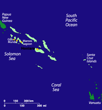
 Traveling to the Solomon Islands is not easy, with a troubled economic infrastructure, and fewer flights landing in its capital Honiara; however, the world-class scuba diving, fishing, snorkelling, and birding, as well as the colorful culture and the welcoming nature of the islanders makes this place very much worth a visit. Historically, interest in the Solomon Islands is focused on the role they played in the Pacific during World War II–the wreck-strewn waters of Iron Bottom Sound are testament to the strategic importance of the islands.
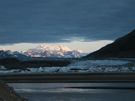
 On every river you can find one place that’s so full of mystery, life, and beauty, that it’s like finding the very heart of the river itself. It may be a shadowy, swirling pool that reflects light in such a way, you could swear you were seeing into another world. Or it could be an easy bend where the rush has undercut the bank, and trees’ roots dip into the stream. They are images of every river, but something about that particular spot makes it seem different, unique, and inspired. On the Alsek, you can find that place after each turn.
 The Alsek River is not easy to find (it’s short, often not labeled on maps or in atlases) and a challenge to get to: we traveled to Juneau, Alaska, a capitol city accessible only by air and sea, and took a ferry on the Alaska Marine Highway system up the spectacularly immense Lynn Canal fjord to the panhandle fishing town of Haines. From there, we drove five hours in a school Area of interestbus into the Yukon Territory, Canada, to the Kluane National Park and Reserve town of Haines Junction; then we hiked in several hours to the banks of the Dezadeash River–near the confluence of the Kaskawulsh River–just upstream from where the Alsek begins in earnest. Here, we joined our guides, acquainted ourselves with the two-ton (loaded) inflatable oars rafts that would be our primary mode of transportation for most of the next two weeks, and set off downstream.
 On our hike into the launching point, we saw the first of eight bears (black and grizzly; a low number, compared to some trips, but we weren’t disappointed), as well as any number of regionally specific birds, including trumpeter swan, golden eagle, and Arctic tern. We were a group of fourteen, including three highly experienced professional guides. Ours was a private trip organized by an old friend, Mike Pratt, who had run the Alsek more than any man before him; he would be our lead guide on the river, and this would be his last commercial trip down it, before settling into married life in his home back in the contiguous United States. The gear, itinerary, and all three guides had signed on through the international adventure travel company Mountain Travel Sobek.
 But danger is only one side of the equation. Depending on your method of travel–using a professional company, with guides who are also great cooks, storytellers, naturalists, and jokesters; or a self-guided trip down the river, which can be not only more dangerous (for not having at least an idea of what to expect), but also less inspiring, if you’re not totally familiar with the Alsek–for every threatening moment, there can be ten more that are comforting and even luxurious. On our third day, camping at a site we called “Sandblaster” because of its uncomfortably strong winds and barren sandy landscape that pelted us horizontally in the gusts, we were treated to an exhilarating hike up Goatherd Mountain, from the top of which we had the best vantage possible of the enormous Lowell Glacier–a frozen river of mud and ice so wide it resembles a 50-lane superhighway; then we feasted at the river’s edge on a delicious dinner of fresh grilled sockeye salmon and vegetables, with tea and hot chocolate; followed by a site I thought I’d never see in such wilderness: a makeshift–but ingeniously engineered–sauna, made from a spare tent covered with heat-trapping tarps, the steam created by dripping glacier water over three heavy steel bricks that had been buried in the fire pit for hours. Later, our night was defined by the blowing wind and the rhythmic rumble of icebergs calving into the river, and well before the rest of camp rallied, a few of us woke for a glorious view of the 3:30 A.M. sunrise over the ever-present Mounts Kennedy, Alverstone, and Hubbard, which themselves seemed to rise out of the much closer Lowell Glacier. It is the kind of picture, I think, mere words cannot describe adequately. Even a photograph seems only to partially capture the environment of the Alsek. In the end, I knew, I was witnessing among the best the earth had to offer; after this trip, I thought, I would not sense the world around me in the same ordinary terms I once had.
 There are several places on the Alsek where I thought the world had invented itself in the most striking and beautiful possible form. The purple sunrise on Mt. Hubbard, behind the meandering Lowell Glacier; the fresh fallen snow on a jagged nameless peak that reminded me of something from a Tolkien novel; the churning holes in the great rapid Lava North, for which we donned dry suits and an extra measure of courage to run (falling in the river there can mean certain death, if you get caught in an eddy); or the eerie silence on a foggy morning as we gathered firewood on a sandbar at the head of Alsek Lake. But despite all of these amazing natural wonders, the time my adrenaline hit its peak was not while immersed in the unadulterated landscape of the Alsek, but rather, while hurtling through the air, hundreds of feet above the seven-mile-long face of the Tweedsmuir Glacier, staring down at the boiling cauldron of rapids in the impassable Turnback Canyon, from the relative safety of a speeding helicopter. This was our portage day.
 Alsek Lake was the site of our final night. But more than that, it was a culmination for me: so full of grace and beauty, awesome size and geology, wildlife, quietude, color, and light that I thought, if the entire two weeks were spent there alone, the trip would still have been amazing. The entrance into the lake began at the tail end of one of the most arduous rains we experienced. After paddling through the morning, we stopped at a beach at the head of Alsek Lake. A short walk through fields of wildflowers–blazing Indian paintbrush, fireweed, goldenrod, and more–opened up to the iceberg-laden water, still hidden in afternoon fog. Through that mist, we’d find our last camp.
 As we tied our boats together–creating a single, wide float–and paddled among the ice, with blue evening sky overhead and a rainbow of colors reflecting off the surrounding water, I spotted the flash of a great bald eagle sweeping down the valley wall. Graceful, fast, and furious with its talons flared, the eagle slammed into the placid lake and almost immediately began to struggle under the weight of the salmon in its claws as it took flight again. It was an image I had only dreamed of up to that point. And as that dream slipped into reality, I thought, that–for me–was the true heart of the Alsek.
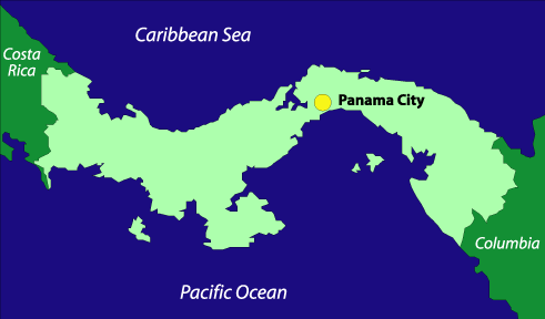
 Panama has a checkered past, but as a modern country it runs one of the world’s most important waterways, the Panama Canal, and has built for itself a large offshore investing business. From its capitol at Panama City to its rainforests and rich coastlines, Panama is a beautiful land, but it suffers from increasing crime and an uncertain government.